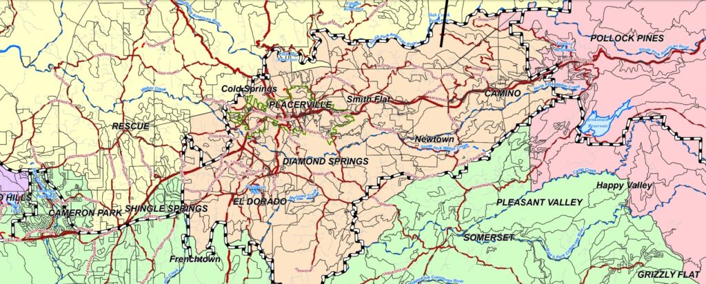
(PLACERVILLE, CA) – As part of the redistricting process currently underway in El Dorado County, alternative maps under consideration for Board of Supervisors districts are now available for public viewing.
Following the August 19, 2021, release of census data for the redistricting effort, El Dorado County’s Geographic Information System (GIS) staff and the Redistricting Team finalized a system to display the data and for the drawing of new boundaries for each of the County’s five supervisorial districts. The Surveyor’s Office has created four maps, each of which meets the requirements for equal population distribution among the districts, as well as geographic contiguity, integrity of local communities of interest and cities, consideration of natural and man-made barriers, and compactness. These preliminary alternatives can be found at the County’s Redistricting web page under “Draft Maps”.
The public mapping application allows the public to provide comments on specific areas of the County and the map alternatives overall, and provides instructions for use. The public may also access and download data and the census files to create their own maps for consideration.
A review of map alternatives provided by the Redistricting Team as well as any submitted by the public will be provided at the next Redistricting public meeting, which is scheduled for October 14, 2021.
The U.S. Constitution requires a national census every 10 years, after which Congressional and state legislative district lines are redrawn to reflect changes in population. California law requires boards of supervisors to use the federal census data to redraw supervisorial districts.
Alternative #1: City Based Alternative
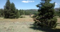
This alternative was derived by allocating census blocks starting on the west end of the county and moving east considering City boundaries as the priority. It also uses rural centers and public drawn communities of interest as secondary considerations. This alternative maintains the City of Placerville in District 3 and the City of South Lake Tahoe in District 5, and it takes into account the proposed El Dorado Hills City boundary from a 2005 proposal. It also keeps the El Dorado Hills business park within a single district, whereas it has been split between two districts in the past. Lastly, it keeps the Tahoe Basin and much of the El Dorado National Forest together.
To view details, different map layers, and to comment on this alternative, click here to view the Public Comment App and turn on the “City Based Alternative” layer. We have also prepared instructions on how to use this tool to send in your comments.
Alternative #2: Community Services District Based Alternative
This alternative was derived by working along the Highway 50 corridor from the west to east end of county considering community services districts first and city boundaries and rural centers second. While it is not feasible to prevent CSDs such as El Dorado Hills and Cameron Park from being partially split due to the high population density in those areas, the majority of CSD boundaries were kept within a district.


To view details, different map layers, and to comment on this alternative, click here to view the Public Comment App and turn on the “CSD Based Alternative” layer. We have also prepared instructions on how to use this tool to send in your comments.
Alternative #3: Community of Interest (COI) Based Alternative
For this alternative, public drawn communities of interest were the primary consideration for district boundaries. A total of four COIs were submitted for consideration by the public. These included communities in the Shingle Springs, Cameron Park, Rescue, and Pollock Pines areas. Specific plans, rural centers, and cities were also considered in an attempt to prevent heavily populated areas and neighborhoods from being split into separate districts.
To view details, different map layers, and to comment on this alternative, click here to view the Public Comment App and turn on the “Community Interest Based Alternative” layer. We have also prepared instructions on how to use this tool to send in your comments.
Alternative #4: Community Region Based Alternative
In this alternative, community regions, as defined in the county’s general plan, were the primary consideration for district boundaries. In addition, rural centers, Community Services Districts, Caldor fire victims, cities, and the proposed El Dorado Hills city boundary were included as secondary considerations. This alternative uniquely considers the victims of the Caldor Fire by putting a majority of the affected population within a southern district that stretches from the western edge east to the Tahoe Basin. Lastly, this alternative combines many of the major historic areas, such as Placerville, Coloma, and Georgetown, into a common district.
To view details, different map layers, and to comment on this alternative, click here to view the Public Comment App and turn on the “Community Region Based Alternative” layer. We have also prepared instructions on how to use this tool to send in your comments.
About Post Author