(NWS Sacramento)
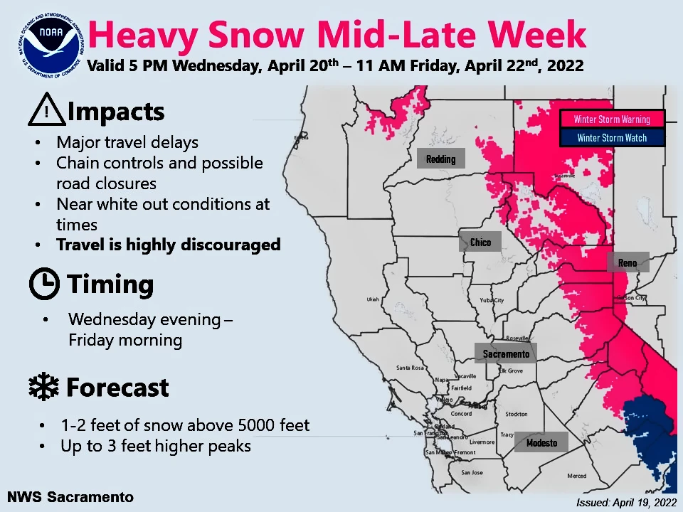
PLACERVILLE, Calif. — Heavy mountain snow will impact mountain travel late Wed-Friday morning.
Mountain travel is HIGHLY DISCOURAGED during this time.
If you do travel, be prepared for chain controls, travel delays, & near whiteout conditions at times.
Extended forecast for 4,500 ft – Pollock Pines
Detailed Forecast
Tonight
Partly cloudy, with a low around 37. Southwest wind 6 to 8 mph becoming south southeast after midnight.
Wednesday
A 20 percent chance of showers after 4pm. Increasing clouds, with a high near 56. South southwest wind 8 to 14 mph, with gusts as high as 23 mph. New precipitation amounts of less than a tenth of an inch possible.
Wednesday Night
Showers. Low around 40. South wind 9 to 13 mph, with gusts as high as 22 mph. Chance of precipitation is 90%. New precipitation amounts between a half and three quarters of an inch possible.
Thursday
Showers and possibly a thunderstorm. High near 44. South southwest wind 13 to 18 mph, with gusts as high as 28 mph. Chance of precipitation is 100%. New rainfall amounts between 1 and 2 inches possible.
Thursday Night
Rain showers before 5am, then rain likely, possibly mixed with snow showers. Some thunder is also possible. Low around 36. South southwest wind 5 to 9 mph becoming light after midnight. Chance of precipitation is 90%. Little or no snow accumulation expected.
Friday
A chance of rain and snow showers before 8am, then a chance of rain showers. Partly sunny, with a high near 47. Chance of precipitation is 50%. Little or no snow accumulation expected.
Friday Night
Mostly clear, with a low around 34.
Saturday
Sunny, with a high near 58.
Saturday Night
Clear, with a low around 40.
Sunday
Sunny, with a high near 65.
Sunday Night
Mostly clear, with a low around 44.
Monday
Mostly sunny, with a high near 66.
Monday Night
Partly cloudy, with a low around 46.
Tuesday
Sunny, with a high near 64.