[ENF]
EL DORADO COUNTY, Calif. —
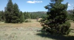
It has been months since a wildfire that burned through El Dorado County at a threatening pace, causing unprecedented evacuations and mostly leveling an entire community, has been extinguished. Now, much of the nearby federal forest land is reopening to the public.
The Eldorado National Forest section of the U.S. Forest Service said most of the area where the Caldor Fire burned will be open again for visitors starting April 1. However, officials are warning people to remain cautious as recently burned areas can still pose as hazards.
The forest service is asking people to be wary of the following if visiting Eldorado National Forest:
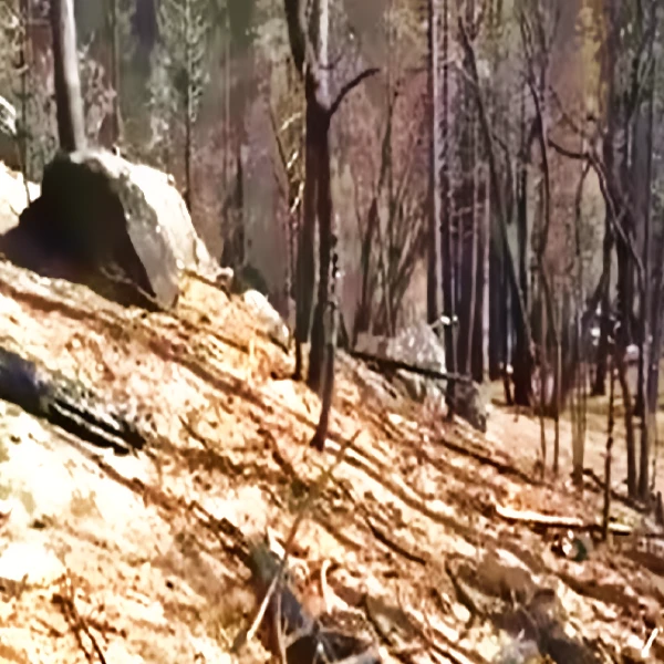
- Dead or damaged trees that can fall over, blow down or drop limbs without warning. Visitors are urged not to picnic, camp or park a vehicle close to dead trees, and to stay clear of dead trees on windy days.
- Burned stumps that might have hollow root chambers from fire burning through it. The root chambers can collapse over time, but a person’s body or vehicle weight on the root chambers can also lead to collapse and possible also open holes in the ground.
- Landslides. When plants die and their roots decompose, they can no longer bind soil in place, leading to a risk of soil and rock shifting and moving easier. Storms or wet weather can also trigger landslides and rockfall.
- Flash floods and debris flow at burn scars. The destruction a wildfire leaves behind include exposed soil from burnt vegetation and debris. Intense rainfall after fires can trigger flash floods. Visitors are asked to not recreate in areas where wildfires recently burned during wet weather. The forest service says to get to high ground and to not try to hike or drive through if caught in a storm, as entire roads or trail surface can be washed away.
These are the areas that are still closed due to wildfire damage.
- Elkins Flat OHV Trail System
- 11N46 (Alder Creek Road)
- 10N40 (Plum Creek Road)
- 42 Milestone Day Use Area
- Caples Creek Trailhead
- Caples Equestrian Trailhead
- Capps Crossing Campground
- China Flat Campground and Day Use Area
- Eagle Rock Day Use Area
- Elkins Flat OHV Staging Area
- Gray Rock Campground
- Lyons Creek Trailhead
- Martin Meadows Campground
- Pyramid Creek Trailhead
- Silver Fork Campground
The Caldor Fire, which started Aug. 14 east of Omo Ranch and south of the community of Grizzly Flats, burned 221,835 acres and actively burned for over two months, according to Cal Fire.
It wouldn’t be until Oct. 21 when firefighters fully contained the wildfire. With complete containment, that means crews established barriers around the fire’s perimeter, whether by manmade means such as trenches and backburns or through natural means like rivers and terrain fire can’t spread through.
Even after a fire is fully contained, hotspots within the containment perimeter can continue to burn for days, weeks and months afterward the main threat is controlled. However, heavy rain and a late 2021 snowstorm in the Sierra helped dampen much of the area where the wildfire burned.
While crews had managed to spare most communities from the path of the fire, the Caldor Fire managed to tear through most of the community of Grizzly Flats. Residents are rebuilding, but many have had to relocate after losing their homes.